

Home > Destinations > New Mexico >Guadalupe Ruin & Tapia Canyon
Guadalupe Ruin & Tapia Canyon
GUADALUPE RUIN LIES IN THE HIGH DESERT OF CENTRAL NEW MEXICO AND IS ONLY ACCESSIBLE ON DIRT ROADS THAT ARE IMPASSIBLE AFTER RAIN STORMS.
Located on a sandstone cliff, about 200 ft. above the valley. Access this archaeological site through a short, somewhat steep and narrow trail that leads to the top of the mesa, where you’ll find 39 rooms and 7 kivas plus great view of the surrounding area.
After your visit, you can proceed a little down the same road, to Tapia Canyon for a moderate 8 mi. day hike.
Guadalupe Ruin Overview
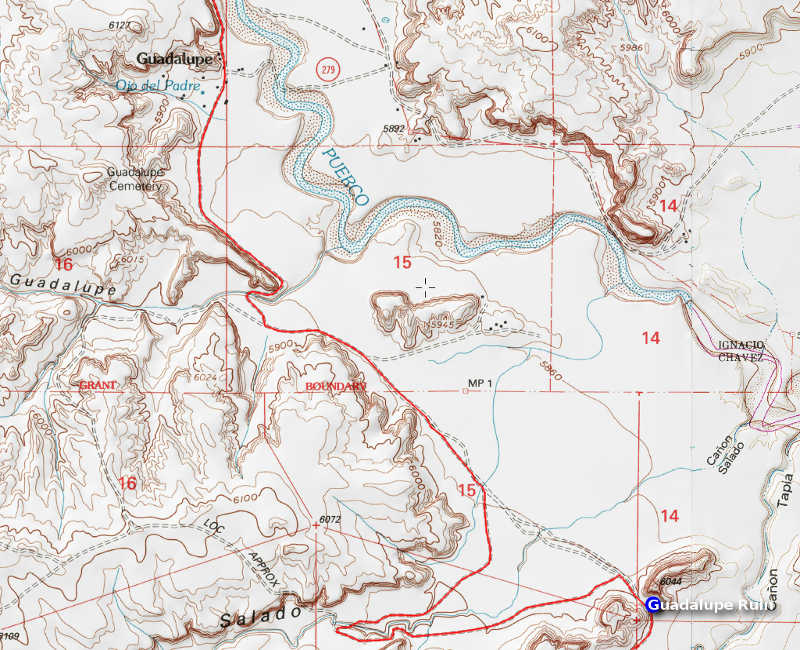 Continue 3.5 mi. to a deep wash (10), which is impassable days after it rained. Guadalupe Ruin is about another mile on the left. It’s a short, but walk up to the ruins. Entry to the Tapia Canyon is another 0.5 mi. further down the road.
This is real backcountry and only attempt this with a reliable vehicle with a full tank of fuel. The roads can be nearly impassable after rainstorms and 4WD may be necessary. Watch out for herds of cattle.
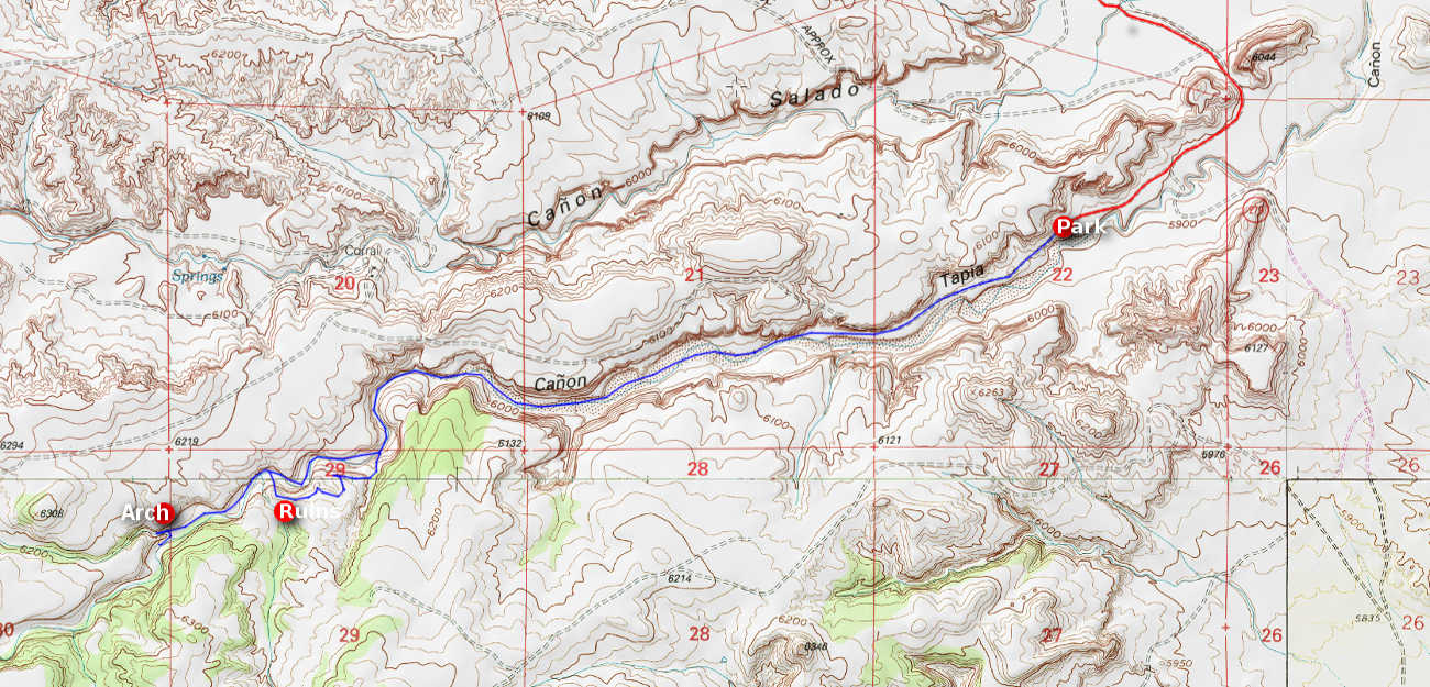
Tapia Canyon Overview

Tapia Canyon Trail
 Trail Details:
Pass a fence to enter the canyon and then mostly follow the streambed all the way to the arch. You’ll find a slot canyon behind the natural arch.
On your way back, make a steep climb up the canyon wall to view some petroglyphs and a sacred Navajo site “Tower Ruins” which is still in use and closed during specific times of the year.

Closed to ensure privacy for sacred Native American traditional activities:
- Sep 15 – Oct 15
- Dec 15 – Dec 31
- Mar 1 – Mar 15
- Jun 20 – Jun 30
Appears to be an absolutely incredible hike! We’d love to do it, but can probably do only 4 miles. What would you suggest in this area?
This is not a hike for unexperienced hikers. Especially during inclement weather, its remote location clearly poses risks. A completely different, yet enjoyable outing is El Morro National Monument located south of the I-40. It offers a few very basic hikes and a lot of history, in addition to free camping.
This area of New Mexico is ‘inundated’ with trails and hikes and one that I like lies SE of the monument and is called Dittert Archaeological Site. More of a real hike of simple to moderate difficulty and easy to access. Up to 7 miles distance or less if you so desire.
I haven’t done these hikes recently, so always verify access and weather conditions, before heading out.
Van Williams